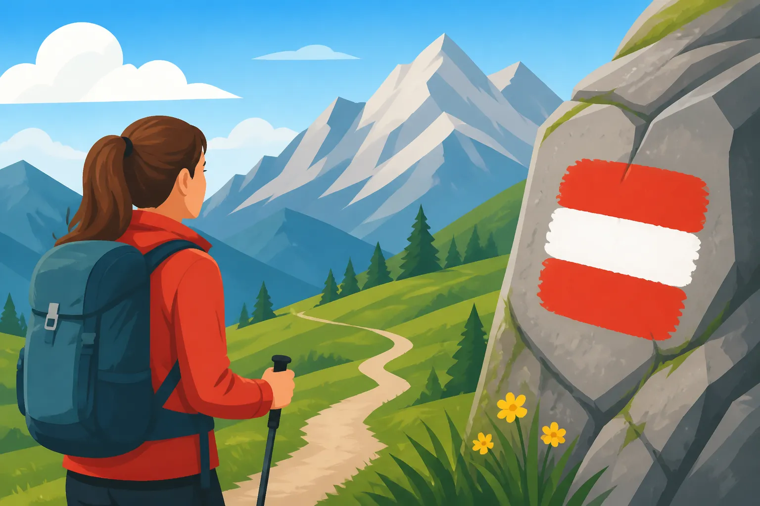
Reading Red-White-Red Hiking Trail Markers in Austria
Standing at the base of a jagged trailhead in the Salzkammergut, it is incredibly easy to feel overwhelmed by the cryptic symbols painted on rocks and the dense clusters of yellow signs pointing toward the clouds. I remember my first solo trek near Hallstatt, where I naively assumed a red-white-red stripe meant "this way to the view," only to find myself breathless and clinging to a limestone ledge far beyond my skill level. This guide serves to demystify the Austrian trail classification system so you can navigate the Alps with the confidence of a local and avoid the dangerous mistakes many newcomers make.
The Logic of the Austrian Wayfinding System
When you first start exploring the outdoors as part of your Living in Austria 2027: The Expat Starter Guide, you will notice that the trail markings are not random graffiti. They are part of a meticulously maintained national standard governed largely by the Austrian Alpine Club (ÖAV). The system is designed to communicate three things simultaneously: direction, destination, and difficulty. Unlike trail systems in North America or the UK that might use mileage or simple names, the Austrian system is built around the "Wegzeit" or walking time, and a color-coded difficulty scale that mirrors the European ski slope system.
The most iconic symbol you will encounter is the red-white-red flag painted on trees, fence posts, and boulders. In the hiking context, this specific tricolor pattern indicates a "Bergweg" or mountain path. However, the nuance lies in how these marks interact with the yellow directional signs found at every major junction. Understanding the hierarchy of these signs is the first step toward mountain safety. In Austria, the responsibility for your safety lies primarily with you—a concept locals call "Eigenverantwortung." The signs provide the data, but you must provide the judgment.
Yellow Directional Signs and Time Estimates
The yellow aluminum signs, known as "Wegweiser," are the backbone of alpine navigation. Each sign will list a destination, such as a mountain hut (Hütte) or a peak (Gipfel), followed by a time estimate. One of the biggest shocks for expats is that distance is almost never listed in kilometers. This is because a three-kilometer flat walk around a lake is fundamentally different from a three-kilometer ascent up a vertical ridge.
The times listed are calculated using a standardized formula (DIN 33466) that assumes an average hiker covers about 300 meters of elevation gain per hour or 4 kilometers of flat distance per hour. If you are hiking with children or are not yet "mountain fit," I highly recommend adding 20% to 30% to the listed time. I learned this the hard way during a sunset hike in Tyrol when the "1 hour" sign actually took me nearly 90 minutes, leaving me to navigate the final descent in the dark.
Decoding the Difficulty Circles
On every yellow sign, you will see a colored circle—either blue, red, or black. This is the single most important piece of information for your physical safety. A blue circle indicates an easy path (Talweg or Spazierweg) that is wide and requires no special balance or equipment. These are perfect for families or those still adjusting to the altitude.
A red circle signifies a moderate mountain path. This is where you will see the red-white-red painted markers on the trail itself. These paths are often narrow and steep, and they may include short sections where you need to use your hands for balance. If you are venturing onto red trails, ensure you have reviewed the Innsbruck Healthcare Guide: Alpine Safety and Medical Care to understand the risks of mountain terrain. Finally, a black circle indicates a "Schwarzer Bergweg" or difficult alpine trail. These are for experts only. They often involve "Seilsicherungen" (fixed steel cables), significant "Absturzgefahr" (danger of falling), and require a total lack of vertigo.
Reading the Red-White-Red Painted Markers
Once you leave a junction and follow a red-marked path, you will see the red-white-red stripes every few hundred meters. These are confirmation marks. Their primary purpose is to reassure you that you are still on the "official" maintained path. In the dense forests of Styria or the foggy peaks of Vorarlberg, these marks are your lifeline.
The placement of these marks is intentional. Often, a mark is placed just after a confusing fork in the woods to show you which branch is the correct one. If you walk for more than ten minutes without seeing a red-white-red stripe, stop immediately. You have likely wandered onto a "Jägersteig" (hunter's path) or a cow trail.
The Role of the Alpine Association
The maintenance of these markings is a Herculean task performed by volunteers. These individuals carry heavy tins of paint and brushes up thousands of meters of elevation every spring to ensure the marks remain visible after the winter snows. Because of the high quality of this maintenance, many expats find that they don't need a GPS for most well-traveled routes.
However, joining the national climbing organization offers more than just gratitude for the paint. I strongly suggest looking into the Benefits of Alpenverein (Alpine Club) Membership for Expats. Beyond the community, the membership includes a specialized insurance policy that covers helicopter rescue—something that is not covered by standard public health insurance and can cost upwards of €5,000.
Intersections and Turn Markings
Sometimes, you will see the red-white-red stripes bent into an "L" shape or an arrow. This is a critical signal that the trail is about to make a sharp, sometimes counter-intuitive turn. In rocky terrain, locals might also pile stones into small towers called "Steinmännchen" (cairns). While these are helpful, always prioritize the official painted red-white-red markings, as cairns can sometimes be built by well-meaning but misguided tourists.
Alpine Safety and Personal Preparation
Reading the signs is only half the battle; you must also be prepared for the environmental hazards that the signs cannot predict. The Austrian weather is notoriously fickle. A blue-sky morning in the valley can turn into a lightning storm on the summit within thirty minutes. Before heading out, it is wise to check local mountain weather apps like Bergfex or ZAMG.
Furthermore, being in the mountains exposes you to biological risks. In the lower-altitude forests of the Alpine foothills, ticks are a significant concern. Make sure you are aware of the risks of Tick Bites in the Alps: When to See a Doctor before you spend time brushing against tall grass. Additionally, while the air feels cool, the UV radiation at 2,000 meters is intense. Proper hydration is essential, and while many hikers wonder, Is Austrian Tap Water Really Safe to Drink Everywhere?—the answer is yes in the cities, but you should never drink directly from mountain streams located below grazing cattle (Almrausch) due to the risk of parasites.
Essential Gear for Red-White-Red Trails
For any trail marked with red-white-red symbols, sneakers are insufficient. The limestone in the Austrian Alps becomes incredibly slick when wet, and the "Schotter" (loose scree) can easily cause a rolled ankle. You need "Wanderschuhe" (hiking boots) with a Vibram sole or similar high-traction tread.
Your backpack should also be a miniature survival kit. Even for a short three-hour hike, I always carry a foil emergency blanket, a whistle, and a basic first aid kit. If you are planning more ambitious treks, you should consider Building an Emergency Go-Bag for Natural Disasters that can double as your mountain safety kit. In a country where the terrain is this vertical, preparation is the difference between a great story and a call to the mountain rescue.
Understanding Mountain Rescue and Insurance
If the worst happens and you lose the red-white-red markers or suffer an injury, you need to know who to call. The general European emergency number 112 works, but the specific Austrian mountain rescue number is 140. When you call, be prepared to give your coordinates or describe the last yellow sign you passed.
Because mountain rescue is a specialized private service, it is financially vital to have the right coverage. Standard insurance like ÖGK often falls short in the wilderness. You should read about Ambulance Fees and Mountain Rescue Costs (Alpinpolizze) to ensure you aren't stuck with a massive bill after an accidental injury. Many expats also find the Do I Need Alpinpolizze (Skiing Accident Insurance)? guide useful, as it often covers summer hiking accidents under the same policy umbrella.
Comparison of Austrian Trail Classifications
To help you choose your next weekend adventure, I have summarized the three main categories of trails you will encounter. Use this table to match the markers on the trail with your current fitness level.
| Trail Category | Sign Symbol | Trail Marking | Skill & Gear Needed |
|---|---|---|---|
| Easy (Gelber Weg) | Blue Circle | None or Blue/White | Walking shoes; suitable for all fitness levels. |
| Moderate (Bergweg) | Red Circle | Red-White-Red | Sturdy boots; sure-footedness and moderate fitness. |
| Difficult (Alpiner Steig) | Black Circle | Red-White-Red | Expert boots; no vertigo; alpine experience. |
Practical Tips for Your First Expat Hike
When you are ready to put your knowledge to the test, start with a "Hüttentour." Austrian mountain huts are a cultural phenomenon where you can get a hot meal of Kaiserschmarrn and a cold drink after a long ascent. Finding the right trail usually starts with a visit to the local "Tourismusverband" (tourist office) or using an app like DocFinder's outdoor equivalents.
If you are hiking in the summer, remember that heat can be a silent killer even in the mountains. Refer to my advice on Preventing Summer Heatstroke During Vienna Heatwaves for tips on staying cool that apply equally to the steep climbs of the Rax or Schneeberg. If you are feeling unwell during your hike, don't hesitate to use resources like Calling 1450: Austria's 24/7 Telephone Health Advice Line for non-emergency medical guidance.
Finally, always inform someone of your planned route and expected return time. Many mountain huts have a "Hüttenbuch" where you can log your name and next destination. This isn't just a tradition; it's a safety protocol that helps rescuers narrow down your location if you disappear between the red-white-red markers. For more general safety information, keep the guide to Emergency Services in Austria: 144, Hospitals, and Crisis Steps saved on your phone.
Navigating the Austrian Alps is one of the most rewarding aspects of living here. The red-white-red marks are not just paint; they are a promise that a path has been cleared and checked for you. Respect the colors, trust the yellow signs, and always keep an eye on the horizon. The mountains are beautiful, but they demand your full attention and respect. If you plan to transition into winter sports later in the year, be sure to also check out Skiing Etiquette and Lift Line Rules in the Austrian Alps to stay safe on the snow.
Disclaimer
This guide is intended for informational purposes only and does not constitute professional mountain guiding advice. Alpine environments are inherently dangerous and weather conditions can change rapidly. Always consult local weather reports and trail conditions before departing. The author and publisher are not responsible for any injuries or accidents occurred while using the Austrian trail system. Always ensure you have adequate mountain rescue insurance before hiking in high-altitude terrain.